Saturday, July 5th, 2025 18:37 ZJul. 5, 2025 18:37Z
Satellite Imagery
Contents:
Positions of geostationary satellites GOES-West (GOES-18), GOES-East (GOES-16), Meteosat 0 degree (Meteosat-11), Meteosat IODC for Indian Ocean Data Coverage (Meteosat-9) and Himawari-8. While this is not a complete listing of geostationary satellites, these are the ones this page mainly focuses on.
This page focuses mostly on visible and infrared satellite imagery. Additional satellite-derived data is available on our Wind Data page (upper level wind, surface wind imagery and satellite-derived intensity estimate techniques) and our Ocean Data page (sea surface temperature and waves).
GOES-East and GOES-West Imagery
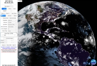
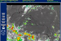
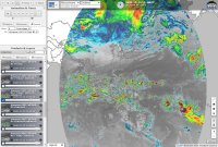
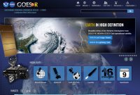
Example of GOES-R Series home page
The National Oceanic and Atmospheric Administration's (NOAA) "latest generation of Geostationary Operational Environmental Satellites (GOES), known as the GOES-R Series, is the nation's most advanced fleet of geostationary weather satellites. Geostationary satellites circle the Earth in geosynchronous orbit, which means they orbit the Earth's equatorial plane at a speed matching the Earth's rotation. This allows them to stay in a fixed position in the sky, remaining stationary with respect to a point on the ground. GOES satellites continually view the Western Hemisphere from approximately 22,300 miles above Earth. GOES satellites are designated with a letter prior to launch and renamed with a number once they reach geostationary orbit." GOES-R Mission Overview | Wikipedia article about GOES satellites
GOES-East (GOES-16; Wikipedia article) is a geostationary satellite located above 0°N 75.2°W and provides views of most of North and South America, including most of the Atlantic Ocean and parts of the eastern Pacific Ocean.
GOES-West (GOES-18; Wikipedia article) is a geostationary satellite located above 0°N 137.0°W and provides views of most of the eastern and central Pacific Ocean, including parts of North America. On January 4th, 2023, GOES-18 replaced GOES-17 as GOES-West. (about)
These satellites are part of the GOES-R series of satellites.
"The Advanced Baseline Imager is the primary instrument on the GOES-R Series for imaging Earth's weather, oceans and environment. ABI views the Earth with 16 different spectral bands (compared to five on the previous generation of GOES), including two visible channels, four near-infrared channels, and ten infrared channels." You can learn more here, where you can download an in-depth PDF fact sheet for each band. Imagery is available for the full disk (usually every 15 minutes), Contiguous U.S. (CONUS, usually every 5 minutes) and two mesoscale regions (usually every minute) that change. You can learn more about that here. You can view the GOES-R series FAQ here.
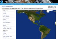
GOES Imagery Viewer from NOAA NESDIS' Center for Satellite Applications and Research (STAR)
Storm specific floater imagery available for the Atlantic, East Pacific and Central Pacific.
This is the primary site to view data from GOES-East and GOES-West on. You can view storm floaters here. Floater imagery is not available for invests on this site. You can view floaters from NOAA for invests on the site here.
All 16 spectral bands can be viewed. In addition to each of those, there are also "RGB" products that include "GeoColor", "Air Mass", "Sandwich", "Day Cloud Phase" and "Nighttime Microphysics". Their viewer allows you to loop imagery. In addition to "Full Disk" and "CONUS" views, you can also choose regional views across the U.S. There are also wider regional views for the "Gulf of Mexico", "Caribbean", "U.S. Atlantic Coast", "Puerto Rico" and "Tropical Atlantic". The "Full Disk" and "Tropical Atlantic" imagery is updated every 10 minutes, while the other imagery is updated every 5 minutes. The two mesoscale sectors are also available. When available, they are updated every minute.
This viewer comes from the Regional and Mesoscale Meteorology Branch (RAMMB) of NOAA / NESDIS (National Environmental Satellite Data and Information Service) and the Cooperative Institute for Research in the Atmosphere (CIRA).
All 16 spectral bands can be viewed. In addition to each of those, there are also other products that include "GeoColor (CIRA)", "Natural Color (EUMETSAT)", "Airmass (EUMETSAT)", "Dust (EUMETSAT)" and others. Their interactive viewer allows you to zoom in and loop imagery. You can overlay multiple layers on top of each other. Mesoscale sectors are also available. You can choose the time step you want, from 5 to 480 minutes for the CONUS and 10 to 960 minutes for the Full Disk. You can choose between 6 to 60 images for a loop.
Data from other satellites is also available. Meteosat-11 for the eastern North Atlantic, Southern Atlantic, Africa, Europe and parts of eastern South America. Meteosat-9 for the Indian Ocean, Africa, western Asia and Europe. Himawari-8 for the western Pacific, eastern Asia and Oceania. (You can choose to view imagery for Japan in addition to the "Full Disk".) Two polar-orbiting satellites, Suomi NPP and NOAA-20, provide global views twice daily. (You can choose to view either the Northern or Southern Hemisphere.) You can learn more about those satellites later on this page.
You can download imagery from this viewer, including loops, when you click the "Download Options" button. You can read the instructions after you click that button to learn more about it. Once you have select the imagery you want to create a single image or image loop for, as well as have adjusted the size of your browser window to determine the width and height of the generated imagery, you can click that button. Depending on the file size of an image loop, it might not be easily saved in Google Chrome. In Mozilla Firefox, it might have black lines between image tiles. You can instead choose to generate images that you can individually save. Then you can create an image loop on your own if you have software to do it or use a free web based tool to animate the imagery. It's best to create smaller images if you want to have a long image loop.
Note: When testing this viewer we found that when a loop of one of the two mesoscale sectors lasts beyond when the position of the mesoscale sector changed, the "Maps" overlay option reflected the location of the current mesoscale sector position, even in imagery in the loop for the previous mesoscale sector position.
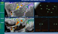
SSEC's RealEarth™ from the Space Science & Engineering Center at the University of Wisconsin-Madison
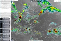
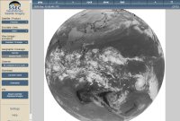
Example of the RealEarth™ interactive viewer
Global imagery available.
All 16 spectral bands can usually be viewed for the Full Disk, CONUS and two mesoscale sectors. The Geostationary Lightning Mapper (GLM) (about) overlay is also available. You can also add a wide variety of other overlays, which you can learn about later in this section. Their interactive viewer allows you to zoom in and loop imagery, giving you more control over the imagery than most any other viewer.
The default "Collection" selected in their viewer is "RealEarth". To view all the available overlays, select "All categories". If some of the layers in the "RealEarth" collection disappear, be sure to select "All categories". In the past, they have sometimes reorganized what is shown and changed what folders certain overlays appear in. You can also view a complete listing of all their available products here. Make sure that you check the date of the imagery available to make sure that it is current as you will find some products that do not have current data.
To find GOES-East and GOES-West imagery in their display, click the "Products" tab in the left column. Look for the folders that have names that start with "GOES East" and "GOES West". Each folder has overlays for the various spectral bands and additional enhancements. If you don't see all the bands, you will need to make sure the "All categories" collection is selected. As of updating this section, the "Geostationary Lightning Mapper" is at the bottom of the "GOES East Full Disk" folder and the overlay is named "GOES East GLM Full Disk Group Density".
The links below load specific overlays into the side panel that you can then choose from to add to the map.
This site has an incredible amount of satellite imagery available on their interactive map. (you can choose Google Maps as a base map or use their simple map) You can add as many layers as you want at one time, setting the transparency of each. You can zoom in for more refined imagery. The imagery can also be looped in their viewer. You can select the time steps in your loop, such as an image every hour or every 6 hours, as well as set how many images you want to view in the loop. You can also control the speed of the loop. While the amount of archived data available varies, you can often go back a week for some of the more popular satellite options. In the "Global" imagery folder you will find imagery that often updates every hour. In the "Continental US" folder, for imagery just near the U.S., often every 15 minutes. For "Continental US" and "Global Imagery" you can view a variety of layers such as "Visible", "IR Aviation" (AVN), "Infrared" (B&W), "Dvorak", "Funk Top", "Tops" (overshooting tops), "Rainbow" and others. You can also find radar overlays in the "Radar" folder. There are hundreds of other overlays. View more data here at the Science & Engineering Center.
You can also view the data in Google Earth. When you click the "Share" button you can save a link with the options you have selected as well as find a link in the window that pops up about saving a KML file in Google Earth. In that window you can also save the imagery as a PNG image or even save the current loop you are viewing as either an animated GIF image or MP4 movie file.
After you view a certain amount of imagery per day in the RealEarth™ display, a watermark will appear on the imagery. You can double the amount of imagery you can view per day if you register on their site for free. Beyond that, you will need to pay if you want to remove the watermark. You can learn more here.
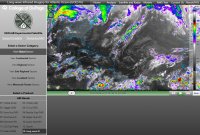
Example of a page at the College of DuPage with satellite data
All 16 spectral bands can be viewed for the "Global", "Continental", "Regional", "Sub-Regional", "Localized" and "Mesoscale Floater" sectors. In addition to each of those bands there are also "RGB Color Products" that include "True-Color", "Airmass", "Natural Color", "NT Microphysics" and "Day Cloud Phase". You can view an image loop from 6 to 200 frames. You can also choose a frame interval if you would like to show only every second, fourth, sixth or twelfth frame in a loop.
Near the top left corner of the imagery you can click the small globe icon ("Product Overlays") to add various mapping and data overlays for most of the sectors. There are various tabs that will appear that contain various overlays. The "Mesoanalysis" tab contains overlays such as "Composite Radar", "CAPE", "CINH" (convective inhibition), "Dewpoint", "Mass Divergence", "Wind Gusts", "500mb RAP Analysis", "Moisture Divergence", "Mean Sea Level Pressure", "Pressure Falls", "Station Plots", "Present Weather", "Supercell Composite", "Streamlines", "Temperature", "Theta-E", "Theta", "Vorticity", "Wind Vectors" and "Watches & Warnings". The "GOES Derived" tab contains overlays such as "Cloud Top Height", "Cloud Top Temperature", "Cloud Top Phase", "Aerosol - Dust", "Aerosol - Smoke", "Land Surface Temperature", "Rainfall Rate", "Sea Surface Temperature", "Total Precipitable Water" and "GLM Flashes" (Geostationary Lightning Mapper). If you don't see all the overlays on each tab, adjust your browser window so that you are able to see the scroll bar so that you can scroll down. While you can't zoom in on an image, the imagery scales to the size of your browser window. For closeup imagery, view "Localized Sectors" and select the area you want to focus on.
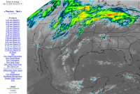
Example of NASA's SPoRT page for GOES-East CONUS
All 16 spectral bands can be viewed for the Full Disk and CONUS. Additional products include Air Mass RGB (about, PDF file), Dust RGB (about, PDF file) and others. You can't select how many images you would like to view in a loop, so you could find yourself viewing a loop with well over a hundred images and over a hundred megabytes. You can't zoom in on imagery. The link above is for the infrared band 14 for CONUS. Once on the page you can select the other bands and use the "Animate This Product" link at the bottom of the left column to animate the display. The Geostationary Lightning Mapper (GLM) product is also available here for CONUS. Once on the page you can select a different domain, including "Full Disk", "Caribbean", "Southeast US", "Puerto Rico" and "South America".
You can also view imagery from the Himawari-8 and Meteosat-11 satellites. For other imagery, click "Real-Time Data" in the menu at the top of the page.
Example of satellite imagery from NASA's MSFC imagery viewer
There are six spectral bands available for GOES-East and GOES-West imagery: Red Visible (band 2), Snow/Ice Near-Infrared (band 5), Shortwave Infrared (band 7), Upper-Level Water Vapor (band 8), Clean Longwave Infrared (band 13) and Longwave Infrared (band 14). Each is available for the Full Disk and CONUS. There are therefore twelve different options to choose from for each satellite. For each of those you will be able to center your satellite view, with two to three zoom levels available, depending on the band and/or sector you are viewing, to zoom in closer. You will have additional image enhancements that are standard with all of their imagery; ten for infrared and six for water vapor. CONUS imagery is updated every 5 minutes and the "Full Disk" imagery every 10 minutes.
Our site used to have a viewer that allowed you to more easily navigate imagery from their site. While you can still use the viewer here, it no longer works like it used to due to security upgrades on their site. The viewer might not work properly and might be removed in the future.
Example of satellite imagery from SSEC's Geostationary Satellite Imagery viewer
Global imagery available.
In addition to their RealEarth™ viewer, they also have this one. For GOES-East and GOES-West, it has B&W imagery for each of the 16 spectral bands. Imagery is available for the "Full Disk", "Contiguous US" and both mesoscale sectors. (As of updating this section, the mesoscale sectors are marked as experimental.) You can set an image loop to have the maximum number of images available, which can sometimes exceed 200. Other satellites are available in that viewer as well, including Himawari-8 (listed as "Himawari"), Meteosat-11 (listed as "MET-PRIME"), Meteosat-9 (listed as "MET-IODC"), Fēngyún-2G (FY-2G, a geostationary Chinese satellite, listed as "FY2G") and EWS-G1 (formerly GOES-13, and formerly operating as GOES-East, a geostationary satellite now managed by the U.S. Department of Defense that might be over about 61.5°E). When we checked their viewer in November 2020, they also had imagery for COMS-1 (a geostationary South Korean satellite over 128.2°E that is also known as "Chollian-1") but it had not been updated since March 2020.
Example of satellite imagery from Environment Canada
Their site has imagery from both GOES-East and GOES-West for not only Canada, but also the United States, the Atlantic and even Full Disk imagery. Their "Eastern North America" imagery shows all of the western Atlantic, including the Gulf of Mexico and the Caribbean. Their "Eastern USA" imagery shows a closer view, with the eastern U.S. Atlantic coast, eastern Gulf of Mexico and northern islands in the Caribbean shown. They also have some polar orbiting imagery from NOAA.
Example of satellite imagery from NOAA's Aviation Weather Center
Global imagery available.
Their site has infrared (B&W or color), visible and water vapor (color) imagery. Imagery from satellites around the world are combined in a global mosaic. Depending on the satellite, "by international agreement", some of the imagery might be up to 3 hours old. The imagery that contains polar regions is likely geostationary satellite imagery combined with imagery from the JPSS constellation.
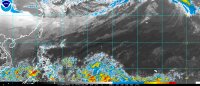
Example of IR satellite imagery in the Caribbean from PSU's Tropical Atlantic e-WALL page
In the left column of that page you will find several different satellite views, including floaters. Once you select a satellite view, you will then see a new left column with more satellite options, including choosing 8, 16 or 24 image loops.
Example of the GOES-East imagery selection home page from PSU
In addition to that page, another area of their site here has infrared and visible satellite imagery for various regions of the U.S. that you can select from.
This site also has various other data, including model data.
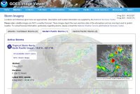
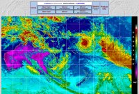
Example of storm imagery (floaters) from NOAA's GOES Imagery Viewer
Storm specific floater imagery available for the Atlantic, East Pacific and Central Pacific.
GOES-East and GOES-West floaters are available on this site. We describe this site in the GOES section at the top of this page. Floaters are not available for invests on this site.
Example of the home page for NOAA's Office of Satellite and Product Operations
Storm specific floater imagery available. (including for invests)
This site has floaters for tropical cyclones around the world. You can access the floater page here directly. You can also access floater imagery from the main page by clicking a storm icon on the map and then clicking "Imagery". This site also has a variety of other data.
In 2018, GOES-East imagery moved to NOAA NESDIS' Center for Satellite Applications and Research (STAR) from this page. We link to that newer site in the section above. In 2019, GOES-West imagery moved to the new site as well. This occurred when new satellites, with additional image options that they could offer, became operational. Floater imagery for the Atlantic, East Pacific and Central Pacific were moved to the new site at the time. However, at some point later floater imagery also became available again on this different site in the format the older imagery was in. Unlike the new site for GOES imagery, this site still has floaters for invests too.
The older site has Polar Satellite Imagery and you can find that here.
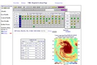
NRL Tropical Cyclone Page from the Marine Meteorology Division of the U.S. Naval Research Laboratory - Monterey
Example of NRL's Tropical Cyclone Page
Global imagery available.Storm specific floater imagery available.
For developed storms and areas of investigation as well, NRL has impressive visible imagery centered right on the storm. The site has IR imagery as well and a lot of other various satellite features that make this one of the best places to research a storm.
CIMSS Tropical Cyclones from University of Wisconsin-Madison's Cooperative Institute for Meteorological Satellite Studies
Example of CIMSS' Tropical Cyclone front page
Global imagery available.Storm specific floater imagery available.
This site has a lot of impressive features, including storm centered satellite imagery. It has shear, dust, convergence, divergence, vorticity, wind, ADT estimates and steering current data you may be familiar with. Click an active storm on the map on the main page and you will access a display with a wide variety of features that allow you to easily overlay storm specific data.
In the map below the map with current storms, you can hover your mouse over a region to access other imagery, including general satellite imagery. They have water vapor and infrared (B&W, as well as NHC and Dvorak color enhancements) satellite imagery in the "Images & Movies" section for each region, but that satellite imagery in that particular section only updates every 6 hours. For some of the imagery on their site you can loop it by selecting either the "2-Day Movie" or "5-Day Movie" option, depending on the imagery type. Sometimes it is in the top right corner and sometimes it might be located below the imagery.
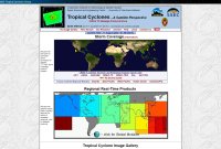
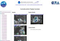
Example of Currently Active Tropical Cyclones page on CSU's site
Global imagery available.Storm specific floater imagery available.
You can select an active storm on the page to view various storm specific satellite imagery for a storm, including visible, infrared and water vapor imagery. There are also a lot of other storm specific products, including wind analysis, ocean heat content imagery and satellite intensity estimates. The top of a storm page also has a link to model data products for the storm.
Various satellite views are available, including for the Contiguous U.S., Atlantic, Gulf of Mexico, Northwest Atlantic, Western Atlantic, Central Atlantic, Eastern Atlantic, Eastern Pacific, Central Pacific and Alaska. Both mesoscale sectors for both GOES-East and GOES-West are also available.
This site has some visible and IR floaters like the "Currently Active Tropical Cyclones" page they have.
Overlays for Google Earth
If you have the desktop version of Google Earth, a free program, you can download and open the files below to view various overlays.
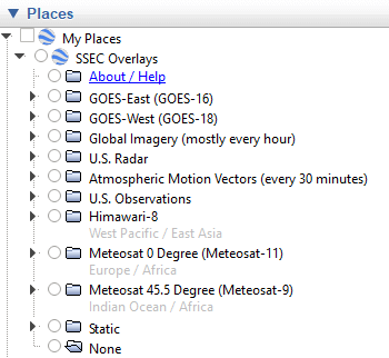
SSEC Overlays for Google Earth
Screenshot of SSEC Overlays in Google Earth's sidebar.
Global imagery available.
This Google Earth file contains overlays from the Space Science & Engineering Center (SSEC) at the University of Wisconsin-Madison. It contains imagery from GOES-East (GOES-16), GOES-West (GOES-18), Himawari-8, Meteosat-11 and Meteosat-9. You can learn more about those satellites later on this page. You can also view these overlays in their interactive web based mapping product, RealEarth™. Image loops are available in their web based mapping product.
After you view a certain amount of imagery per day, a watermark will appear on the imagery. You can double the amount of imagery you can view per day if you register on their site for free. Beyond that, you will need to pay if you want to remove the watermark. You can learn more here.
Current Version: 2.12 (January 10th, 2023) - Updated links for new GOES-West satellite.
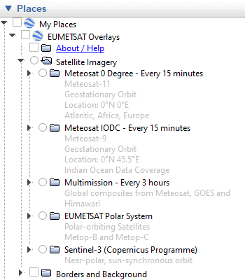
EUMETSAT Overlays for Google Earth
Screenshot of EUMETSAT Overlays in Google Earth's sidebar.
Global imagery available.
This Google Earth file contains satellite overlays from the European Organisation for the Exploitation of Meteorological Satellites (EUMETSAT). It contains imagery from Meteosat-11 and Meteosat-9 every 15 minutes. It also has imagery from the EUMETSAT Polar System (Metop) and Sentinel-3 (Copernicus Programme). It has global composites from Meteosat, GOES and Himawari, though that data is every 3 hours. You can learn more about some of those satellites later on this page. You can also view these overlays in their interactive web based mapping product here. Image loops are available in their web based mapping product.
Current Version: 1.22 (June 26th, 2022) - Updated to work with their new viewer.
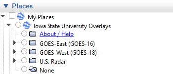
Iowa State University Overlays for Google Earth
Screenshot of Iowa State University Overlays in Google Earth's sidebar.
This Google Earth file contains satellite overlays from the Iowa Environmental Mesonet (IEM) at Iowa State University. It contains imagery from GOES-East (GOES-16) and GOES-West (GOES-18).
Current Version: 1.01 (January 10th, 2023) - Updated which satellite is now GOES-West.
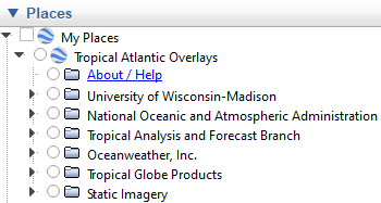
Tropical Atlantic Overlays for Google Earth
Screenshot of Tropical Atlantic Overlays in Google Earth's sidebar.
You can view a variety of image overlays using our overlay product. Over the years, less image overlays are available that fit properly in Google Earth. To view satellite imagery, the other Google Earth overlay files we have are incomparable to this one. We'll still leave this overlay product until there are few overlays left available in it.
Current Version: 2.10 (June 27th, 2022) - Removed some overlays that were no longer available and updated some others.
World Coastlines from Natural Earth
Screenshot of world coastlines in Google Earth.
The desktop version of Google Earth no longer has coastlines available. This file contains world coastlines that will disappear as you zoom in close, similar to how it used to work in Google Earth. This file was adapted from a shapefile (.shp) here from Natural Earth. This file includes major islands, but excludes smaller islands that are less than 2 square kilometers. It also does not contain any data for lakes. For a file that has minor islands, click here. For a file that includes some lakes, click here.
Screenshot of NASA's Blue Marble layer (left) and Earth at Night layer (right) in Google Earth.
These layers make a great background to overlay other imagery or data onto. The Blue Marble imagery, from August 2004, comes from here. The Earth at Night imagery, from 2012, comes from here. We then added each image to its own Google Earth file so that it didn't rely on a network link to download data. A lower quality image exists within the file. By doing this, you can add other image layers on top of this one. If you select a layer in the "My Places" panel, you can use the opacity slider on the various layers that you use.
Please note that since each of these files is about 4 to 5 megabytes, and a layer will be loaded for the entire globe, opening these files in Google Earth could crash the program if you do not have sufficient memory. Please save all the work on your computer before trying to open them.
If you don't need to add image overlays over these layers, and you would like to have higher quality imagery, you can use Google Earth network links instead that load imagery from NASA's Global Imagery Browse Services (GIBS) using their Tiled Web Map Service (TWMS). The Google Earth network link for Blue Marble imagery is here and the one for Earth at Night imagery is here.
Saharan Air Layer (SAL) Analysis
Saharan Air Layer Analysis from University of Wisconsin-Madison's Cooperative Institute for Meteorological Satellite Studies
This can show you dry air and/or dust that might affect tropical waves and cyclones. A variety of imagery is available, including "Split Window", "Natural Color", "RGB Airmass", "Water Vapor" (Upper, Mid and Low-Level) and "RGB Dust".
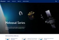
Meteosat Series home page from EUMETSAT
The European Organisation for the Exploitation of Meteorological Satellites (EUMETSAT) "currently operates Meteosat-9, -10 and -11" satellites in a "geostationary orbit (36,000km) over Europe and Africa, and the Indian Ocean. The Meteosat satellites are operated as a two-satellite system providing detailed full disc imagery over Europe and Africa every 15 minutes and rapid scan imagery over Europe, every five minutes. Meteosat imagery is crucial for nowcasting, which is about detecting rapidly developing high impact weather and predicting its evolution a few hours ahead, in support of the safety of life and property. Observations are also used for weather forecasting (as input to numerical weather prediction models), and for climate monitoring." "Meteosat satellites have been providing crucial data for weather forecasting since 1977." You can learn more about the Meteosat Series of satellites from EUMETSAT here. You can also find some information through Wikipedia here.
EUMETSAT has a wide variety of image types from their Meteosat satellites on their site. You can view information guides on some of their imagery here. The layers in their interactive viewer are available for other sites to use as WMS layers. You can click here for the WMS GetCapabilities request that you can use.
You can view information in the PDF document here about the Meteosat Second Generation (MSG) satellites. In the "Other Sites" sections below we include links to some sites that have each specific channel. Some sites have eleven channels and some sites also include the twelfth channel (HRV, high resolution visible).
For status information on data from their satellites, as well as GOES-East, GOES-West and Himawari-8, visit their Operational Service Status Indicator (OSSI) page here.
The "CIMSS Satellite Blog" sometimes includes imagery from Meteosat satellites. You can view the "Meteosat" category on their blog here.
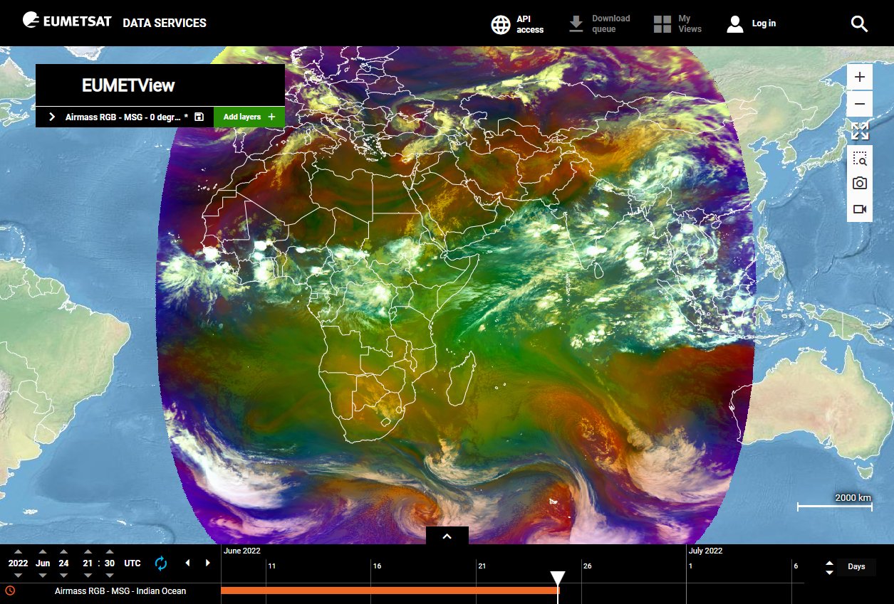
Meteosat-11 (Meteosat 0 degree)
Position: 0°N 0°E - Satellite coverage for Eastern North Atlantic, Southern Atlantic, Africa and Europe
EUMETSAT's Imagery:
Example of Meteosat 0 degree imagery from EUMETSAT's interactive viewer.
The default starting view is of Europe. You will need to pan to the area you want to view.
The H-SAF H03B product (precipitation rate at ground) on their site replaces the previous Multi-Sensor Precipitation Estimate (MPE) for Meteosat 0 degree. You can read more about that here and view the H-SAF web page for more information about it. You can also read more about it on the Meteosat 0 degree Visualised Products page. The MPE product remains for Meteosat IODC.
Eastern N. Atlantic / N. Africa / S. Europe. (every 6 hours) Their site has water vapor imagery (B&W and color) and infrared imagery (B&W and color, which includes NHC and Dvorak color enhancements). This site has a lot of other products as well.
Their site has infrared (B&W or color), visible and water vapor (color) imagery. Imagery from satellites around the world are combined in a global mosaic. Depending on the satellite, "by international agreement", some of the imagery might be up to 3 hours old.
Full Disk (single image every 6 hours). Infrared or visible.
Meteosat-9 (45.5 degree Indian Ocean Data Coverage, IODC)
Position: 0°N 45.5°E - Satellite coverage for Indian Ocean, Middle East, Africa, western Asia and Europe
As of June 2022, Meteosat-9 has replaced Meteosat-8 as the satellite for IODC service. Meteosat-8 had operated at 41.5°E. Meteosat-9 operates at 45.5°E. Some sites may still reflect the older satellite name and location.
EUMETSAT's Imagery:
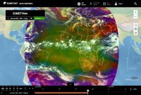
Example of Meteosat IODC imagery from EUMETSAT's interactive viewer.
Full Disk (every 15 minutes). 11 channels, as well as other multispectral RGB composites, mostly in color. Please note that the link still references Meteosat-8. If they update it, try this link if the other fails.
Indian Ocean (every 6 hours). Their site has water vapor imagery (B&W and color) and infrared imagery (B&W and color, which includes NHC and Dvorak color enhancements). This site has a lot of other products as well.
Infrared (B&W or color), visible and water vapor (color). Imagery from satellites around the world are combined in a global mosaic. Depending on the satellite, "by international agreement", some of the imagery might be up to 3 hours old.
Full Disk (single image every 6 hours). Infrared or visible.
Other Meteosat Satellites and Data
Rapid Scanning Service
"The Rapid Scanning Service (RSS) scans the northern third of the Meteosat disc every five minutes." You can learn more the service here and view a schedule of it here. Some of the quotes below come from an older page archived here.
Data from their new interactive viewer (free registration required):
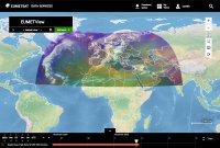
Example of RGB Airmass imagery from Meteosat's Rapid Scanning Service in EUMETSAT's interactive viewer.
About: "Provides the Rapid Scanning Service, delivering more frequent images every five minutes over parts of Europe, Africa and adjacent seas. It also provides Search and Rescue monitoring."
Metop Satellites
You can view surface wind data from the Metop satellites (Metop-B and Metop-C), which are operated by EUMETSAT, on our "Wind Data" page. In addition to the data being on other sites, they also have this surface wind data in their EUMETView service and we link to it here on our "Wind Data" page. (free registration required) While we don't directly link to it, they also have some other data from the Metop satellites in their EUMETView service. (registration is not required for some of the other data)
Himawari Imagery
JMA's Meteorological Satellite Center home page
"The Himawari series of geostationary meteorological satellites", operated by the Japan Meteorological Agency (JMA), "provides constant and uniform coverage of the earth from around 35,800 km above the equator with an orbit corresponding to the period of the earth's rotation. This allows them to perform uninterrupted observation of meteorological phenomena such as typhoons, depressions and fronts." You can learn more here from the JMA. You can also find some information through Wikipedia here.
For the operational status of their satellites, click here. Himawari-8, launched in October 2014, is currently their operational spacecraft. Himawari-9, launched in November 2016, is on standby in-orbit. (and appears to be near the same position as Himawari-8 based on their website) Himawari-9 is scheduled to become operational in 2022 when it will take over for Himawari-8, which would then go on standby. You can view information about that here.
Both Himawari-8 and Himawari-9 contain the Advanced Himawari Imager (AHI). "Himawari-8/9's AHIs have 16 observation bands (3 for
visible, 3 for near-infrared and 10 for infrared)." You can view more information about the Himawari-8/9 satellites in the PDF file here.
Like the GOES geostationary satellites, Himawari also has a mesoscale floater. They have a single one, when available, and it may be referred to as a "Target Area" on some sites. It might be used for such things as tropical cyclones and volcanic ash.
Himawari-8
Position: 0°N 140.7°E - Satellite coverage for the western Pacific, eastern Asia and Oceania
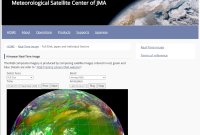
Example of full disk Himawari "Airmass RGB" imagery from JMA's Meteorological Satellite Center page
There are two areas of JMA's site to view Himawari imagery. This area has significant amounts of regional imagery as well as many more imagery types to view. It updates a little slower, by minutes, than the other area that we link to in the next section. While both areas have imagery available every 10 minutes, the other area also has rapid scan imagery for the region near Japan that is available every 2.5 minutes. The other area also allows you to select a time step for imagery, either 10 minutes, 30 minutes or 1 hour, as well as being able to control the speed of the image loop. Imagery is available for the past 23 hours on this area of their site. For the other area, only the last 12 hours are available.
In addition to "Full Disk" imagery, regional views also include imagery for Australia, New Zealand, regional views in Asia and a lot of imagery of various islands in the Pacific. When available, they also have imagery for a "Target Area".
In addition to infrared, visible and water vapor imagery, like the other area of their site, imagery here also includes RGB products such as "Airmass", "Natural Color", "Dust", "Day Microphysics" and "Night Microphysics", as well as "Sandwich".
This area of their site also has derived surface wind data with their ASWind product, which is AMV-based (Atmospheric Motion Vectors) Sea-surface Wind. They have imagery for the northern half of the "Full Disk" and the southern half. (both every half hour) When available, they also have wind data for the "Target Area". (every 10 minutes) If you use this wind product, you should read the important disclaimer on the page here as this product is not a scatterometer. That page also links to a PDF file here with more detailed technical information.
Example of full disk Himawari "Infrared" imagery from JMA's Geostationary Meteorological Satellite page
This area of their site has imagery that updates a little faster, by minutes, than the previous area we mention in the section above. This area only has three regions available. Two are at the link above. They are the "Full Disk" and "East Asia". Imagery is available every 10 minutes for those two regions. The third region is their rapid scan imagery around Japan. You can find that imagery here. It updates every 2.5 minutes. Infrared, visible and water vapor imagery is available for these regions. For their rapid scan imagery, a "Color Enhanced" imagery option is also available. Their rapid scan imagery has imagery from the past three hours available, while the other two regions have imagery from the past 12 hours.
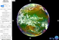
Example of full disk Himawari "Airmass (EUMETSAT)" imagery from SLIDER
Full Disk (every 10 minutes). 16 channels, as well as other multispectral RGB composites, mostly in color. You can also view rapid scan imagery for the area near Japan, where data is updated every 2.5 minutes. In addition to that sector, you can also view the mesoscale sector, when available, which also updates every 2.5 minutes. For those two sectors, only the 16 channels are available.
Example of full disk Himawari channel 13 color infrared imagery from SSEC's RealEarth™
Full Disk (every 10 minutes). 16 channels, with most in B&W and some also available in color. Other RGB composites are also available. When available, you can also view a certain number of image layers for the mesoscale sector here. They include visible, water vapor and infrared imagery. Color image options also exist for water vapor and infrared. There is also another layer for band 7. (for fires) Mesoscale imagery also seems to update every 2.5 minutes, though the display seems to round it off and has imagery intervals of either 2 or 3 minutes.
Example of full disk Himawari channel 15 infrared imagery from SSEC's Geostationary Satellite Imagery viewer
Full Disk (every 10 minutes). 16 channels, all in B&W. An "RGB (True Color)" option is also available, in color. You can view the same options for the "Western Pacific" region.
While this site has a lot of imagery in their display, including all 16 bands, an archive going back to July 2015 and even some target area loops, the display isn't easy to navigate. You can access the imagery for specific bands by clicking the icon in the top left corner and selecting "Asia-Oceania 24h". You can also click here. If you wanted to link to a specific band, you could use the link here for band 1 for example. We never could find a way to automatically play the imagery in the display without creating a link using their "Auto Play" feature and then visiting the link. You can access the "Auto Play Settings" by clicking the icon in the top right corner. It's very difficult to figure out that feature. Once you do select the start and end time, and select loop, you need to click "Show URL". You can then visit the link and it might then automatically play. (sometimes we had issues) They do have an animate button in the display, but it loops separate imagery. You can view a help page about this display here, but it is still very complex to use.
Their site has infrared (B&W or color), visible and water vapor (color) imagery. Imagery from satellites around the world are combined in a global mosaic. Depending on the satellite, "by international agreement", some of the imagery might be up to 3 hours old.
Example of the wide view version of "Tropical West Pacific Imagery" using the "AVN" color for Himawari imagery at NOAA's Satellite Services Division.
A variety of regions, with imagery every half hour. Regions include: "Tropical West Pacific" (wide view), "Tropical East Asia", "Tropical West Pacific", "Tropical Western Australia", "Southern West Pacific", "Japan", "Northwest Pacific", "West Pacific" and "West Central Pacific". Various imagery types, including visible, infrared, water vapor, AVN, RGB and others. This is an older site which used to also have imagery from GOES. Some of the products on some areas of this site no longer update. You can also view some of that imagery here on a newer area of their site, though with less options, where you will find visible, infrared and water vapor loops. You can also view "Full Disk" imagery here on another part of their newer site.
Their SLIDER product mentioned in the previous section has much more imagery, but this older area also has various regional views and some imagery enhancements. When available, some floater imagery is also available. From their site: "Selected Himawari-8 sectors of interest are available below, but every pixel of Himawari-8 imagery is available in SLIDER."
CIMSS Imagery from University of Wisconsin-Madison
Example of "East Australia" imagery using the infrared "NHC" color enhancement for Himawari imagery at CIMSS.
Their site has water vapor imagery (B&W and color) and infrared imagery (B&W and color, which includes NHC and Dvorak color enhancements). This site has a lot of other products as well.
Himawari-9
Position: 0°N 140.7°E - On standby in-orbit
This satellite currently operates as a backup to Himawari-8. It is scheduled to become operational in 2022.
"Himawari-8 was launched and entered operation at 2:00 UTC on 7 July 2015. This was followed on 2 November 2016 by the launch of Himawari-9 which started backup operation in March 2017. Both satellites are scheduled to operate until 2029. Himawari-8 will chiefly be used for observation during the early part of this period, with Himawari-9 in a back-up role. Their operation will be switched in 2022 to place Himawari-9 in the main observational role with Himawari-8 as back-up." (from the PDF file previously mentioned in the introduction section)
Other Satellites
This section contains imagery from other satellites. While there are other satellites with data, this page focuses on some of the ones that have a lot of data available online.
Joint Polar Satellite System (JPSS)
National Oceanic and Atmospheric Administration (NOAA)
NOAA's JPSS Mission and Instruments home page
"The Joint Polar Satellite System (JPSS) is the Nation's new generation polar-orbiting operational environmental satellite system. JPSS is a collaborative program between the National Oceanic and Atmospheric Administration (NOAA) and its acquisition agent, National Aeronautics and Space Administration (NASA). This interagency effort is the latest generation of U.S. polar-orbiting, non-geosynchronous environmental satellites." JPSS was established "as the civilian successor to the restructured National Polar-orbiting Operational Environmental Satellite System (NPOESS). As the backbone of the global observing system, JPSS polar satellites circle the Earth from pole-to-pole and cross the equator about 14 times daily in the afternoon orbit, providing full global coverage twice a day." You can learn more here from NOAA's JPSS site or here from NOAA's Center for Satellite Applications and Research (STAR). You can also find some information through Wikipedia here.
Suomi NPP (Suomi National Polar-orbiting Partnership; SNPP) "is the predecessor to the JPSS series spacecraft and is considered the bridge between NOAA's legacy polar satellite fleet, NASA's Earth observing missions and the JPSS constellation." It was launched on October 28th, 2011. You can learn more about this satellite from the Wikipedia article here.
"NOAA-20, which launched into space on November 18, 2017, is the first spacecraft of NOAA's next generation of polar-orbiting satellites. Capitalizing on the success of Suomi NPP, NOAA-20 features five similar instruments". NOAA-20 was known as JPSS-1 until it reached its orbit. You can learn more about this satellite from the Wikipedia article here.
Additional satellite launches are planned to add to the JPSS constellation.
Among the instruments on the above mentioned satellites is the Visible Infrared Imaging Radiometer Suite (VIIRS). It features 22 spectral bands. You can learn more about the VIIRS instrument here on the JPSS site. You can also learn more about the instrument here from NOAA's STAR site. It has a lot of additional information, including on the various bands. You can also learn more in the Wikipedia article here.
JPSS Data:
RAMMB / CIRA SLIDER from Colorado State University and NOAA
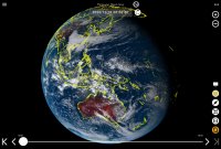
Example of "GeoColor" imagery in the Northern Hemisphere from the JPSS satellite constellation in the SLIDER interactive viewer.
This is likely the best site to view data on from Suomi NPP and NOAA-20. It contains all 22 bands, and other imagery composites, and visually displays it better than other sites we have seen. Over forty total image types are available for each hemisphere.
Orbit of NOAA-20 satellite in RealEarth™ interactive viewer
You can find imagery in the "VIIRS" folder, as well as other products in the folders that start with "JPSS". (There is data for them in some other folders as well, such as one called "GNC-A JPSS".) The link defaults to being available to select a "True Color (Daily Composite)" for both Suomi NPP and NOAA-20.
If you would like to see the orbits of the two satellites, with times at various points along the orbit, click here to view that in the display. These layers take some time to load due to the amount of data points that need to load.
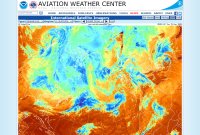
Satellite Imagery from NOAA's Aviation Weather Center
Example of infrared (color) "North Polar Stereographic" imagery for the North Atlantic from NOAA's Aviation Weather Center.
North Polar Stereographic:
You can view visible, water vapor, B&W infrared and two color infrared image types for each region. This site also has international imagery as well. There are a lot of aviation related products elsewhere on the site.
VIIRS Imagery from Colorado State University and NOAA
While we link to these two pages, the best way to view imagery from their site is in their SLIDER display.
Miscellaneous Imagery
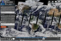
EOSDIS Worldview from NASA's Earth Observing System Data and Information System
Example of MODIS "Corrected Reflectance (True Color)" imagery from NASA's EOSDIS Worldview
Global imagery available.
"This app from NASA's EOSDIS provides the capability to interactively browse over 800 global, full-resolution satellite imagery layers and then download the underlying data. Many of the available imagery layers are updated within three hours of observation, essentially showing the entire Earth as it looks 'right now'. This supports time-critical application areas such as wildfire management, air quality measurements, and flood monitoring. Arctic and Antarctic views of many products are also available for a 'full globe' perspective."
This site gives "you information about NOAA's satellite operations, including various product changes, upgrades and outages. Visit often for the latest information affecting data delivery."
"During eclipse season with the GOES-R satellite series, stray light contamination is visible approximately 45 minutes before and after satellite local midnight (~0500 UTC for GOES-East and ~0900 UTC for GOES-West) each day for approximately 45 days before and after the vernal and autumnal equinox, in the form of a vertical beam of light that is more intense at the end closer to the Sun. Stray light contamination is often prominent in the images of visible and near infrared bands (bands 1–6), although it can also be discerned in band 7 images. This is a normal occurrence for the ABI."

 Storm specific floater imagery available for the Atlantic, East Pacific and Central Pacific.This is the primary site to view data from GOES-East and GOES-West on. You can view storm floaters here. Floater imagery is not available for invests on this site. You can view floaters from NOAA for invests on the site here.